Canal City Shaped by Wind and Waves

The Ranta-Tampella area near the centre of Tampere has within a few years undergone a profound transformation: a canal district for 4,000 residents is being built in place of a motorway dating from the 1970s. In constructing the area, special emphasis has been placed on public outdoor spaces that form a continuous and stylish totality.
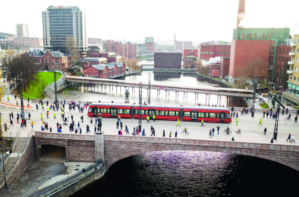
Ranta-Tampella is superbly located next to lake Näsijärvi, just one kilometre from Tampere’s Central Square. To the south is the historical factory district of Tampella, though the areas are separated by the railway line that leads to Pori on the west coast of Finland. Ranta-Tampella was vacated for residential use in 2016, after the completion of the Rantaväylä Tunnel intended for through traffic.
An invitational competition was held in 2009 for the planning of the area, which was won by B&M Architects’ proposal “Horisontti”. Its central concept was the insertion of a canal traversing the area, that would offer views of water also from apartments further away from the lake shoreline.
Architect Jussi Murole admits that the construction of the canal on the shore of the lake initially seemed an absurd idea, but in the case of Ranta-Tampella it was justified due to the north-facing views and exposure to winds. Murole says that with the introduction of the canal they also sought a similar urban atmosphere as in nearby Tammerkoski, where the waterway meanders between red-brick factory buildings. In the competition proposal, the north side of the canal was bordered by a row of point blocks, while slab blocks lined the side facing the railway tracks. The lakeshore was lined with a wall-like frontage of buildings, protecting the interior of the area from the cold northern winds.

Maanlumo Landscape Architecture / Krista Muurinen, Reeta Pellinen, Aapo Pihkala
Architectural Design of Bridges and Canal Ylitys / Hanna Hyvönen, Teo Tammivuori
Location 33100 Tampere
Gross Area 11 ha
Completion 2018–2021
More photos and drawings of the project →
After the competition, the City of Tampere commissioned a reference plan from B&M, on the basis of which the town plan was drawn up. The urban waterfront promenade widened out into a strip-like park, and the serpentine waterfront building frontage was split into three blocks, with the park axes between them connecting the canal to the waterfront park. A 16-storey tower placed at the bend of the canal block would act as a landmark and, unlike the other blocks, it would rise directly from the edge of the canal.
B&M also prepared a building specification guide for the area, according to which the exterior of the blocks must be red brick and the yard sides plastered. Vibrant colours should be used for gable walls. The architects’ office has itself been able to apply these principles to the canal-front point blocks, the first of which will be completed this spring. The plan is based on the proposal that won the plot tendering competition in 2018.
The residential blocks suitably anonymous, emphasising the expressive outdoor spaces and bridges. When walking in the area, however, it is impossible not to notice how few business premises there are as well as the subdued ground-floor levels.
To the east, the outdoor spaces gradually become more urban, culminating in Gustaf Asp Square at the end of the canal.

IN 2014, COMPETITIVE tendering was organised for the design of the shoreline structures, canals and bridges, which was won by a working group formed by the engineering office Pontek, Maanlumo Landscape Architecture and the engineering office Arcus. After the competition, the City of Tampere commissioned from the working group a master plan for the public outdoor spaces throughout the entire Ranta-Tampella area. The parks, public squares and canal fronts have been built in stages since 2017. The designers have nothing but praise for the City of Tampere for their commitment to achieving the ambitious goals.
Landscape architect Krista Muurinen states that the plan for the outdoor spaces is based on two main themes. First, the waves and the winds blowing in from the open expanse of lake Näsijärvi are thought to shape the shore structures, bridges and park areas. Their impact is most pronounced on the lakeshore and at the mouth of the canal, and decreases towards the interior of the area. Second is the interplay between the built urban environment and the natural environment. Ranta-Tampella has been built mostly on landfill, but Nyrkkäkallio at the mouth of the Tammerkoski river has been preserved in its natural state. To the east, the outdoor spaces gradually become more urban, culminating in Gustaf Asp Square at the end of the canal. The park axes between the blocks have been built partly on top of the underground parking facilities, but people in the area hardly notice that they move from an area of solid ground to a parking deck.

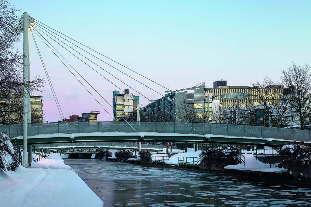
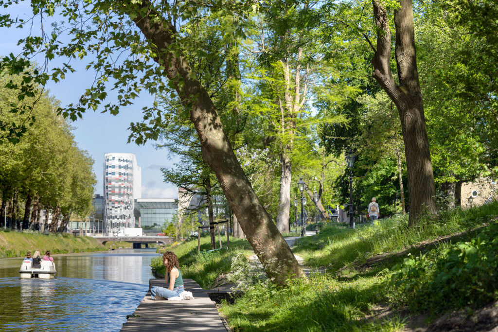
Architects Hanna Hyvönen and Teo Tammivuori were responsible for the architectural design of the bridges. The goal from the very beginning was that the bridges and outdoor spaces would form a seamless totality. This is especially evident at the mouth of the canal, where the fin-like wing wall of the Rantatampella Bridge merges with the steps of Gustaf Asp Square. Four concrete bridges and two steel pedestrian bridges have been built in the area. One end of the concrete bridges extending across the canal is tensioned to the bedrock and the other end is supported on bearings in the canal wall. The artifact-like steel bridges, on the other hand, rest on top of the canal walls. The use of round steel rods for the railings of the canal banks, ramps and bridges also gives the area a cohesive look.
Each of the two banks of the canal have a clearly different character. To counterbalance the straight-lined south side, terraces have been hollowed out of the wall of the sunnier north bank, which serve as seating areas as well as allowing access to the water. There are also concrete observation decks that extend out past the canal wall. The canal walls are constructed of precast concrete panels, the relief pattern of which mimics the reflections in water and chipping rock. The pattern obscures the seams between the panels.
Ranta-Tampella is being developed as a unique canal district, for which no other comparisons really can be found in Finland.
What has been progressive in the construction of Ranta-Tampella is the extensive utilisation of recycled materials. The quarried material created in the construction of the Rantaväylä Tunnel has been used in the embankments, and the cobblestones of the walkways originate from Hämeenkatu in the city centre, which was dug up during the construction of the city’s new tramway system. In turn, the moulds used in the construction of the concrete canal walls were reused as a climbing wall. Circular-economy thinking is also represented in the plan to transform the northern side of the remaining Näsinsilta bridge from a freeway into a park bridge, with the other side remaining a traffic lane.
In addition to the residents of Ranta-Tampella, the waterfront park also serves other residents of the city. There are facilities for a variety of activities, such as fitness equipment, playgrounds, tables and chairs as well as a landing stage for boats. Even on a frosty winter’s day, the park seems to be a popular cycling and walking route. The location in the shade of the residential blocks inevitably limits the use of the park, but by shaping the terrain, places for people to spend their leisure time have been created that face the morning or evening sun.
Ranta-Tampella is being developed as a unique canal district, for which no other comparisons really can be found in Finland. When standing in Gustaf Asp Square, one almost dares to dream of waterfronts full of restaurants like by the river running through the centre of Aarhus in Denmark. ↙